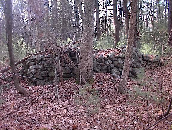
There must have been some farmers around here who were Indians. They might have pretended to be European but, when they went to farming, they would have made an effort to use the land in a way consistent with traditional beliefs - especially where rock piles were concerned. It is even possible that the increased production of waste rock due to farming occasionally led to an increased production of rock piles.

For example: I am climbing Patch Hill in Boxborough and noticing the terracing on the southeastern side and thinking there must have been orchards here. And then along some of the parallel ridges of the terracing I come across rock piles that could just be from rocks pulled out during the digging of the terrraces. But then I come across other rock piles made from ledge rock - from rock broken off from a ledge and then built into a pile. When I get to the top of the rise and find a carefully built rock pile I think: yes field clearing but also something more. I conclude it is not a normal farm. Why couldn't it have been an Indian doing the farming as a laborer or as a landowner? The theory of the "Indian Farmer" says that I don't have to choose between the practical agricultural explanation for a rock pile and a ceremonial one because they are not mutually exclusive.(Indeed, ceremony should never be considered as an alternative to the practical.) It is quite possible for an Indian to have owned a farm and been a farmer and I feel confident that there were Indian Farmers, at least in the orchard towns to the west of here like Boxborough, Bolton, Stow, and Harvard.
Here are some stories about how old the piles are and about who made them - whether farmers, labourers, or people who came back after the farmers were gone and the orchards and pastures had returned to being woods. The idea that someone came back later, an "invisible Indian", has been suggested at different times to explain recent ceremonialism. There does need to be some explanation for recent ceremonialism. Mavor and Dix (1) discuss several prayer seat structures incorporating modern materials or comparatively young trees which, they say, were put there by Indians who continue to live in these towns. Also in a recent screening of a documentary film by Ted Timreck, one of the interviewees in the film said that Indian Farmers would dismiss piles as "just field clearing" and then would turn around and have a ceremony there. So the ideas and observations about the Indian Farmer are percolating up to the surface with other people studying rock piles. All of these ideas and theories try to explain and see ceremonial rock use as consistent with recent times.
There are examples of rock piles made from rocks which were split using a steel drill. The first picture shows a rock fragment with four steel drill holes sitting next to a smaller rock on a support. In the second picture, you can see the drill holes along the near edge of the support rock:
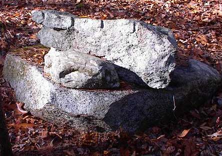
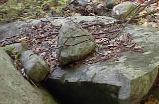
Both example occur near other rock piles. The first occurs near rock-on-rocks and the second occurs near some effigies. Since it is assumed that the steel drill was not introduced here until the 1500s, these piles are no older than the colonial time frame, no more than 400 years old - a pretty crude estimate but a firm one. So far, there is not much evidence for rock piles being older. Some are deeply buried under leaves, roots, and dirt. Others look quite weathered. They could be thousands of years old, but I have no direct observations to report, and no dating technology to apply. Various techniques have been proposed for dating rock piles but, so far, none have been applied to piles around here. They include soil dating, measurement of surface exposure for the rocks, and Carbon 14 dating of organic material from within the rock pile. Using some of these methods in other parts of the country, researchers have found evidence of rock piles up to 2,000 years old (2).
At the other extreme, I have seen a very fresh looking rock pile near the road in Carlisle which was properly placed where water was coming out of the ground. But the individual rocks in the pile were brownish rather than gray. Since rocks come out of the ground as brownish and then turn gray after several years of exposure, I concluded the pile was less than twenty years old. Lichen growth, which is what turns the rocks gray, is an unreliable indicator of age, but its absence suggests an extremely recent date.
We are told (Mavor and Dix, again) that sometimes trees were bent or deliberately knotted near places of ceremony. Here are pictures of one tree that was knotted. In the background of the second picture you can see a platform pile.
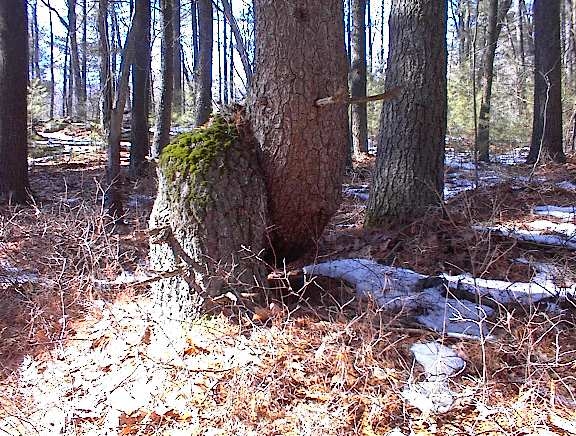
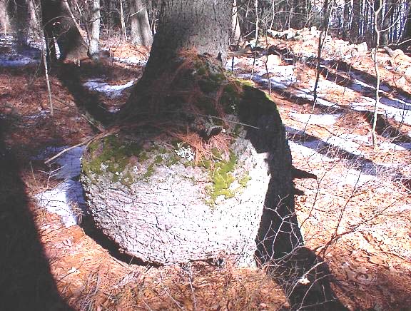
This tree is probably around fifty years old.
Twice in the last year I came across rock piles close to abandoned, falling down log cabins. In both cases the piles were so close to the cabin I could not imagine a person living there who was not also actively using the rock piles. One example was in Falmouth at the edge of the Long Pond conservation land. When leaving Falmouth headed north on Rt 28, the last right hand turn before leaving town is an entrance to utility buildings associated to the park. Back behind there is an abandoned cabin, only a few feet away from a number of small rock piles made from pairs of small cobbles on support rocks. I looked underneath one cobble and noticed that there was still lichen underneath it, growing or maybe dead. How long does it take for lichen to die, dry out and blow away? I do not know. The lichen was black but still there, and I am pretty sure the pile was recent. In addition, the pairs of cobbles seemed a little peculiar; they were not "Twins" in the sense that is familiar to me (as described here). On the other hand the piles are located at the very top of a little gully that curves around and down to join one of the ponds adjacent to Long Pond and this seems like exactly the correct location for rock piles - at the highest point and beginning of a watershed. So the piles were slightly peculiar in design but traditional in placement. The area where Rt 28 leaves Falmouth heading back north seems to have a lot of recent ceremonial stone work. My guess it that the person who lived in this cabin is responsible for it. An old propane tank beside the cabin indicates it was abandoned no more than 30 years or so ago. It would not be too hard to find the name of the person who lived here.
I found a second abandoned cabin, near the edges of Wolf Swamp at one of the headwaters of Beaver Brook in Boxborough.
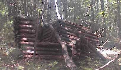
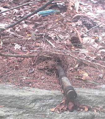
I was exploring a small rock pile site when I noticed the cabin. A few feet away from it were "normal" rock piles and split wedged rocks as well as a pile which incorporated a folded piece of drainpipe:
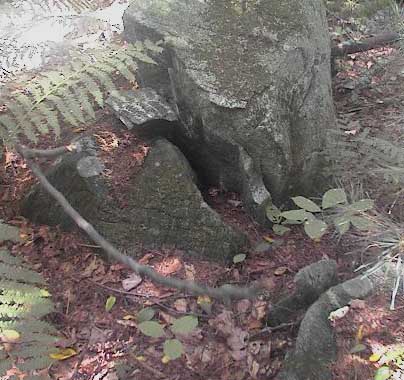
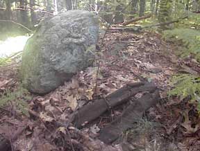
Just some trash near an abandoned log cabin? The backyard of a current residence is across a stone wall from this little site. Could they be responsible for this construction with a bottle and some kind of automobile part?
Other times you come across rock piles right next to some tar paper and trash and other signs that someone might have had a little shack in the woods. I should take more pictures of these when I see them. They might be part of the story. It makes me think back to when I was a kid in the 1960s and you might see a pack peddler walking by, offering to sharpen knives. Or a homeless person. Maybe some of them were Indians
Here is a bolt and ceramic connector sitting on a rock. It might be junk but, on the other hand, these parts are used in conduction of electricity and they were deliberately placed on a rock several yards from the road and a telephone pole which employed the same types of parts. In the second picture, the large piece of glass from the bottom of a bottle looks ceremonial - in fact this pile is near dozens of others and is almost certainly ceremonial.
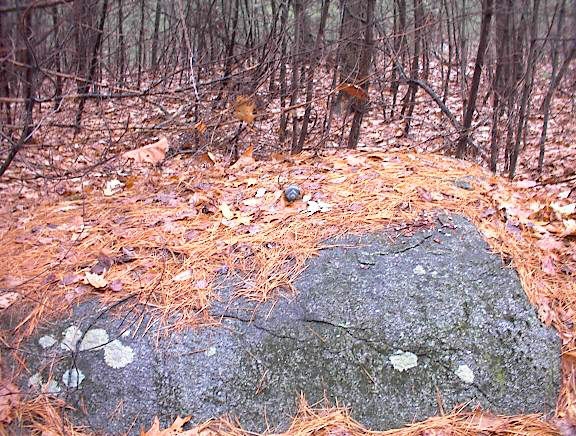
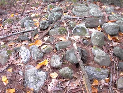
Another example of recent ceremonialsm is found near the Acton "Potato Cave". For several years someone has been moving rocks around there, making piles and creating split-wedged rocks. New things appear from time to time, things which are not quite right and not quite in the correct place. Once I saw a rock pile built on a tree stump. Twice I have stumbled across a new pick-axe with a hickory handle and a bright new blue painted pick head. I saw the same pick-axe in two different places hidden in the bushes. To be clear: someone today is out in Acton moving rocks around and leaving traces of ceremony.
This worries me a little because it is a recent activity taking place near older cermonial sites. Perhaps it is correct, perhaps it is respectful, perhaps it is more knowledgable about these things than me. And perhaps whoever is doing it has much more right to be there than I do. I still see it as confusing the record. A rock pile on a tree stump doesn't seem right.
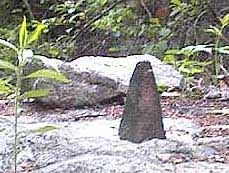
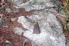
There are examples of recent 'ceremonialism' in the woods which come from the Pagan and Wiccan belief systems. I find more troublesome the residual mess left by these actrivities. For example this little stone pyramid sitting in the ashes from a small fire suggests something Lovecraftian and unwholesome.
Or these little stone circles with a larger standing stones at the cardinal directions.
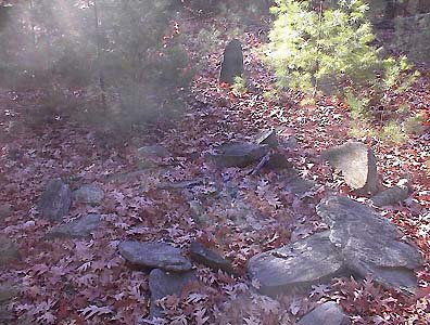
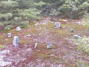
You could put a lot of work into trying to determine the differences between so called "wannabe" structures and the real ones. How exactly do you tell the difference? In general, the answer would come from observing enough of the landscape to be able to recognize which structures are the most common. Things that are rare, recent, or noticeably out of place are most suspect.
There is anecdotal evidence that some European landowners had arrangements with Indians allowing them to visit and continue using the land. For example, Doug Harris of the Narraganssett Tribal Historic Preservation Office, relates that such agreements constituted the accepted means for protecting ceremonial sites. However the old arrangements have been forgotten by the younger generations of landowners and this necessitates a new initiative by the Indians. They are determined to work directly with local towns to preserve ceremonial sites. This is the subject of a United South and Eastern Tribes Resolution (3). I am happy to be able to make the point that the Indians are better judges of what is of ceremonial significance to them than is the Massachusetts Historical Commission.
When you explore a site with a large number of rock piles you see something that is hard to ignore. I think it would be impossible for a landowner to not notice a hilltop, on the property, covered with a hundred rock piles. Or, how could the farmer at Patch Hill not notice an acre of land covered with these? They fill all the space within a quadrant between stone walls.
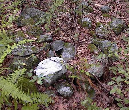
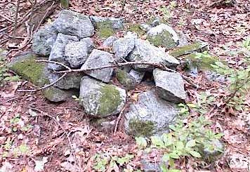
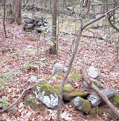
So then, what are we to make of the biggest sites in Harvard, Boxborough, Stow, Acton, Carlisle? I think it is likely the landowners condoned the use of their land for rock pile building, or respected the piles if they were already there. After all, some landowners came from countries in Europe, such as Sweden, with existing traditions of respecting rock piles. Perhaps they simply were not into vandalism and left the rock piles alone. There certainly was a tradition of leaving the Indian graveyards alone but, today, where are those graveyards? What did they look like?
Something that still puzzles me, though, is a couple of cellar holes in Estabrook Woods in Concord, where there are rock piles directly adjacent to the cellar holes. The history of the people who lived on these properties is known (See J. Walter Brain's articles and website (4)) and they are certainly not reported to have been Indians. One cellar hole belonged to Boaz Browne - and this family seems to trace back to England. Boaz married a Katherine Bateman - from an old Concord family. A second cellar hole belonged to Samuel Kibbe - and this family name also traces back to England but I am suspicious that here we might have an "invisible" Indian. In both cases their yards today are as noticeable for the rock piles as for the cellar holes. This is not rock piles off in some distant field but right at the doorstep. So either they made the piles or Indians came back afterwards and used the same places to build rock piles. For example at Kibbe's cellar hole, there is a stone "U" enclosure at the high point looking back down over the house site.
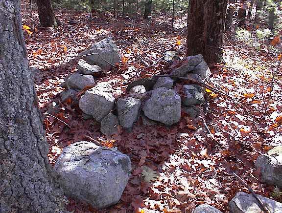
Look around near it and the source of the rock used to make the enclosure is easy to see: they were borrowed from an adjacent stone wall. To me this suggests this "U" was built later than the house site.
I am also pretty suspicious of Patch Hill in Boxborough. Walking there heightened my sense of the mixture of farming and ceremonial practices, too interwoven to try to pull apart. But the Patch family appears to have immigrated to Massachusetts as religious dissenters, and there is no obvious connection to Native American ceremonialism. Beaver Brook Meadow in Boxborough is another place where there are lots of curious and possibly recent stone structures. It looks like an Indian Farm and also a place visited more recently. Perhaps someone's descendants are keeping the place up.
As far as I can tell from the age of things, there were still people actively practicing rock pile ceremonies as recently as the 1960s. That is about the age of some of the fallen down cabins I have seen. Approximately the same date occurs in these stories:
Story #1: A friend and I are walking in Littleton and meet a fellow about our age who is also out walking. My friend mentions that we are out looking for "Indian Stuff", and the fellow says: he is too but this is the first time he ever met anyone else out doing that. Then he told this story: When he was a boy he lived in Chelmsford just over the line from the Great Brook Farm in Carlisle. As a boy he played with his friends in the woods there (in the 1960's) and in one place near some "bumps" [mounds] in the woods they would occasionally run into an old man who was doing something "systematic" and "ceremonial". The old man told them: "You kids watch out when you are playing here. This is a special place". The same old man used to come talk to them when they were fishing in the stream there and ask if they were catching anything. The old man and the boys seemed to share an understanding of keeping out of sight from the farmer.
Story #2: I am visiting a elderly lady in Stow to try to help with protecting the large glacial erratic uphill from her property. She is talking about all sorts of Indian related things in her neighborhood and mentions another lady who lives just north of her and who has a property deed which described one corner of the property as "20 yards from the Indian Spring". Apparently this spring is still there and when the woman was younger, in the 1960's, Indians still would come once a year to visit and to leave pots and pans buried a few inches underneath the pine needles.
Story #3: I went down to talk to the Stow Historical Commission, after talking to the lady of the previous story. At one point I made a reference to the two above stories, saying that I believed Indians had been coming back to the woods here are recently as the 1960's. When I mentioned this, one of the Commission members (a guy perhaps about my age, perhaps a bit younger, sorry I did not get his name), said: When he was a kid he had a friend from Harvard who told a story about a "pit" where the kids would go out drinking. One time he went there and there was an old man there smoking a pipe. The old man said: "This is a very important ceremonial place...don't tell anybody." The kids would usually leave all kinds of trash around the place and once in a while it would get cleaned up. It would get trashed out again and then get cleaned up again.
So that is three versions of the same story. Anecdotal support for the idea of the invisible Indian and the Indian Farmer, as well as supporting the estimate that Indians were still performing some ceremonies around here in the 1960's. My own story from the 1960s is that I was watching Cowboys and Indians on the new black and white TV. Little did I suspect that there might be real Indians out behind my house. And it wasn't just me watching TV. The grandson of the Indian was watching the same shows. But today he is kicking himself and wishing he listened more carefully when grandaddy was telling those stories.
(1) Manitou - The Sacred Landscape of New England's Native Civilization.
James W. Mavor, Jr. and Byron E. Dix.
Inner Traditions International, Ltd. One Park Street Rochester, VT 05767 (1989)(pp. 263-264)
(2) Investigation of Two Stone Mound Localities, Monroe County, Georgia
Richard W. Jeffries and Paul R. Fish (1978)
University of Georgia Laboratory of Archeology Series, No. 17.
(3) Resolution No. USET 2003:022.
Sacred Landscape Within Commonwealth of Massachusetts.
United South and Eastern Tribes.
(4) The Estabrook Woods Cellar Holes
J. Walter Brain
Originally published simultaneously in The Concord Journal, of Concord, Massachusetts, and
The Lincoln Journal, of Lincoln, Massachusetts, in two parts, Part I on
July 12, 2001 and Part II on July 19, 2001. Copyright 2001.
Online at
http://homepage.mac.com/sfe/henry/estabrook/brain/formatted.htm