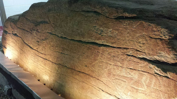
Dighton Rock is a well known boulder with petroglyphs, originally located in the Taunton River at Berkley Massachusetts, but now housed nearby in a small museum dedicated to that rock at Dighton Rock State Park. These might be the petroglyphs with the oldest known documentation in the Americas.
Wikipedia provides a description: Wikipedia: Dighton Rock.
In 2015 Stephen Wilkes of Feldman Geospatial, Boston Massachusetts, used a Faro metrology scanner to scan part of the surface. You can interactively examine the results in the 3D viewer below.

Note: you may need to wait a minute for the 21MB file to load. You will need to rotate the model in order to get the lighting at a good angle for seeing the petroglyphs. Rotate using the left mouse button. Pan using the right mouse button. Zoom using the mouse wheel.
He also used a Leica C10 to generate a point cloud, of which you can view this video: Dighton Rock video
Thanks go to Feldman Geospatial for doing the work and for permission to make these recordings available to NEARA for display on our web site.